Obsidian Rim: Difference between revisions
Jump to navigation
Jump to search
imported>Arkalor |
imported>Arkalor's Bot m Text replace - "Category:Location" to "" |
||
| (3 intermediate revisions by 2 users not shown) | |||
| Line 144: | Line 144: | ||
=== Images === | === Images === | ||
<gallery widths= | <gallery widths=650px heights=200px perrow=3> | ||
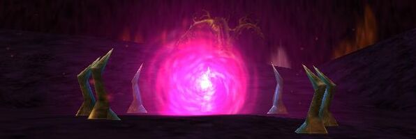
File:Obsidian Rim Live.jpg|Portal to the Obsidian Rim from Singularity Caul. | File:Obsidian Rim Live.jpg|Portal to the Obsidian Rim from Singularity Caul. | ||
</gallery> | </gallery> | ||
[[Category:Geographic Area]] | [[Category:Geographic Area]] | ||
Latest revision as of 12:40, 16 December 2012
|
Description
- Also known as VoD lifestone.
- The Obsidian Rim is generally described as the area surrounding the Obsidian Plains.
- The rim of the plains acts as an excellent starting point when heading into the Valley of Death or as a shortcut to various quests including those found on the northern edge of the Obsidian Plains.
Route
- The easiest access to the Obsidian Rim is via a portal at the Singularity Caul portal drop, which drops you near a Life Stone at 48.0S, 65.0W.
- You can also recall to Aerlinthe, take the Northwest Direlands portal by the drop, and you land by an Obsidian Rim Portal.
- There is also an Obsidian Rim portal inside the Desert March dungeon near Danby's Outpost and in the Direlands Subway.
Related Quests
None
NPCs
| NPC Name | Location | Type | Details |
| Varetha | 44.3S, 62.5W | Quest | Mukkir Aspect of Grael |
Items
| Colban Plant | Dirty Old Crate |
Points of Interest
Lifestones
- 48.0S, 65.1W - Drop point
- 51.6S, 71.1W
Portals
- 49.4S, 70.8W - Northwest Direlands Portal
Dungeons
| Dungeon | Coordinates | Wiki Map | ACmaps | Other | Quests |
| Black Ferah's Vault | 39.1S, 60.1W | -- | -- | -- | |
| Apostate Citadel Mines | 48.7S, 68.9W | -- | -- | -- | -- |
| Chakron Gate | 52.9S, 62.7W | -- | 02AE | -- | -- |
| K'nath Lair | 49.7S, 56.3W | -- | 0193 | -- | -- |
| Shendolain Vestibule | 53.8S, 59.6W | -- | 02E0 | -- | -- |
Creatures
Note: Most landscape creatures have a spawn map on the creature's article page.
Images
-
Portal to the Obsidian Rim from Singularity Caul.
