Northern Landbridge: Difference between revisions
Jump to navigation
Jump to search
imported>Arkalor No edit summary |
imported>Arkalor No edit summary |
||
| Line 1: | Line 1: | ||
[[ | {{Intro | ||
== | | Patch Introduced = [[Release]] | ||
| Related Quests = | |||
| Updated = | |||
}} | |||
{{RightToC}} | |||
=== Description === | |||
The area of land at approximately 15.2N, 50.7W that connects the Northern [[Direlands]] to Northern [[Osteth]]. | The area of land at approximately 15.2N, 50.7W that connects the Northern [[Direlands]] to Northern [[Osteth]]. | ||
== Route == | === Route === | ||
* | * The quickest route is via the [[Lesser Direlands Device]] at your [[Mansion]]. | ||
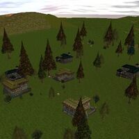
* You can also take the [[Last-Stop-Before-Dires Villas]] Portal outside [[Plateau Village]] at 45.4N, 42.3W. It drops you right at the eastern end of the land bridge. | |||
* | |||
=== [[Points of Interest]] === | |||
{|border=0 cellpadding=3 | |||
| | |||
* [[15.6N, 49.9W - Tumerok Tower]] | |||
| | |||
* [[16.5N, 50.5W - Tumerok Fortification]] | |||
| | |||
* [[Castle Pietrus|19.4N, 49.5W - Castle Pietrus]] | |||
| | |||
* [[10.1N 56.7W - Empyrean Stone Tower]] | |||
|- | |||
| | |||
* [[Ridge Route Mansion|16.3N, 43.0W - Ridge Route Mansion]] | |||
| | |||
* [[19.8N, 53.3W - Cottage]] | |||
| | |||
* [[Peril's Edge Cottages|23.3N, 49.6W - Peril's Edge Cottages]] | |||
| | |||
* [[Dire's Edge|23.1N 54.2W - Dire's Edge Cottages]] | |||
|- | |||
|} | |||
=== [[Lifestone]]s === | |||
* 10.1N 56.4W | |||
* 4.2N, 63.9W | |||
=== [[Dungeons]] === | |||
{{Dungeon Table | |||
| Table Rows = | |||
{{Dungeon Maps | |||
| Dungeon = Mountain Halls | |||
| Coordinates = 10.1N 56.7W | |||
| Wiki Map File = | |||
| ACmaps ID = 0192 | |||
| Other Site Name = | |||
| Other Site Link = | |||
}} | |||
{{Dungeon Maps | |||
| Dungeon = Mount Naipenset Caverns | |||
| Coordinates = 5.6N, 56.2W | |||
| Wiki Map File = | |||
| ACmaps ID = 0147 | |||
| Other Site Name = | |||
| Other Site Link = | |||
}} | |||
{{Dungeon Maps | |||
| Dungeon = Tumerok Mine | |||
| Coordinates = 7.9N, 61.3W | |||
| Wiki Map File = | |||
| ACmaps ID = 01C1 | |||
| Other Site Name = | |||
| Other Site Link = | |||
}} | |||
}} | |||
=== [[Creatures]] === | |||
Note: Most landscape creatures have a spawn map on the creature's article page. | |||
{{Creature Class|Drudge | |||
| Location = Landscape | |||
| <<Creature 1>> | |||
| <<Creature 2>> | |||
}} | |||
{{Creature Class|Shadow | |||
| Location = Landscape | |||
| <<Creature 1>> | |||
| <<Creature 2>> | |||
}} | |||
== | {{Creature Class|Knathtead | ||
| Location = Landscape | |||
| <<Creature 1>> | |||
| <<Creature 2>> | |||
}} | |||
{{Creature Class|Skeleton | |||
| Location = Landscape | |||
| <<Creature 1>> | |||
| <<Creature 2>> | |||
}} | |||
== | === Images === | ||
<gallery widths=200px heights=200px perrow=3> | |||
File:Last-Stop-Before-Dires Villas Live.jpg|Last-Stop-Before-Dires Villas | |||
File:Live.jpg|Caption | |||
</gallery> | |||
[[Category:Geographic Area]] | |||
[[Category:Location]] | [[Category:Location]] | ||
Revision as of 18:56, 25 January 2012
|
Description
The area of land at approximately 15.2N, 50.7W that connects the Northern Direlands to Northern Osteth.
Route
- The quickest route is via the Lesser Direlands Device at your Mansion.
- You can also take the Last-Stop-Before-Dires Villas Portal outside Plateau Village at 45.4N, 42.3W. It drops you right at the eastern end of the land bridge.
Points of Interest
Lifestones
- 10.1N 56.4W
- 4.2N, 63.9W
Dungeons
| Dungeon | Coordinates | Wiki Map | ACmaps | Other | Quests |
| Mountain Halls | 10.1N 56.7W | -- | 0192 | -- | -- |
| Mount Naipenset Caverns | 5.6N, 56.2W | -- | 0147 | -- | -- |
| Tumerok Mine | 7.9N, 61.3W | -- | 01C1 | -- | -- |
Creatures
Note: Most landscape creatures have a spawn map on the creature's article page.
- [[<<Creature 1>>]] [[<<Creature 1>>/Landscape|]]
- [[<<Creature 2>>]] [[<<Creature 2>>/Landscape|]]
- [[<<Creature 1>>]] [[<<Creature 1>>/Landscape|]]
- [[<<Creature 1>>]] [[<<Creature 1>>/Landscape|]]
- [[<<Creature 2>>]] [[<<Creature 2>>/Landscape|]]
- [[<<Creature 1>>]] [[<<Creature 1>>/Landscape|]]
- [[<<Creature 1>>]] [[<<Creature 1>>/Landscape|]]
- [[<<Creature 2>>]] [[<<Creature 2>>/Landscape|]]
- [[<<Creature 1>>]] [[<<Creature 1>>/Landscape|]]
- [[<<Creature 1>>]] [[<<Creature 1>>/Landscape|]]
- [[<<Creature 2>>]] [[<<Creature 2>>/Landscape|]]
- [[<<Creature 1>>]] [[<<Creature 1>>/Landscape|]]
Images
-
Last-Stop-Before-Dires Villas
-
Caption

